...
- Choose an instrument from the selection panel, and its location is displayed on the map.
- Hover your mouse over an instrument pin on the map to see latitude, longitude and depth.
- Click the node icons for details on the node location.
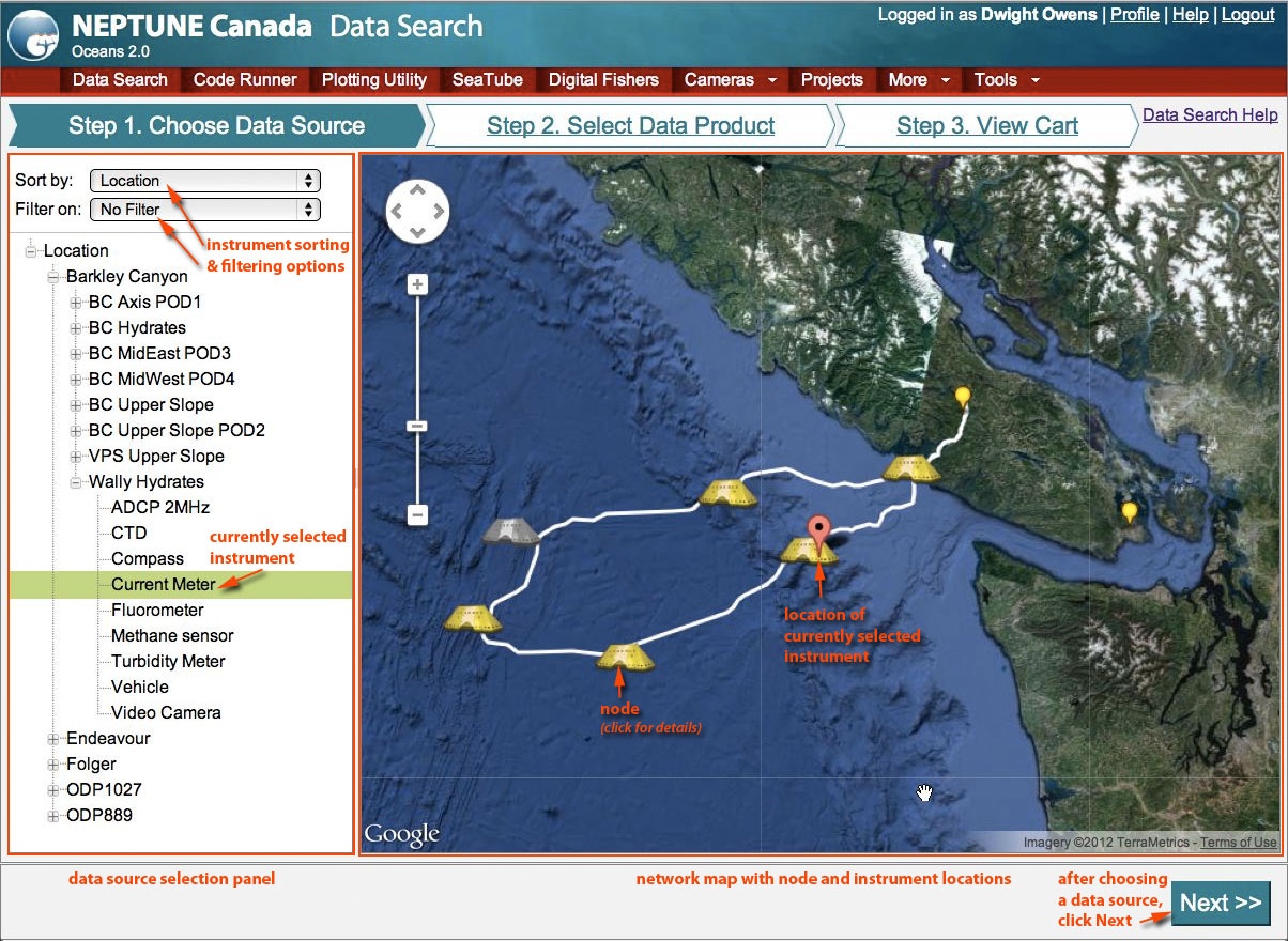
Instrument Selection Panel
...
- date and time periods
- data product types
- data product options (not shown in the illustration below)
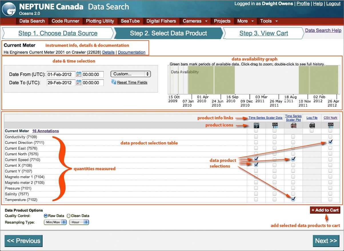
Instrument Info
...
Step 3: Viewing the Cart and Downloading Results
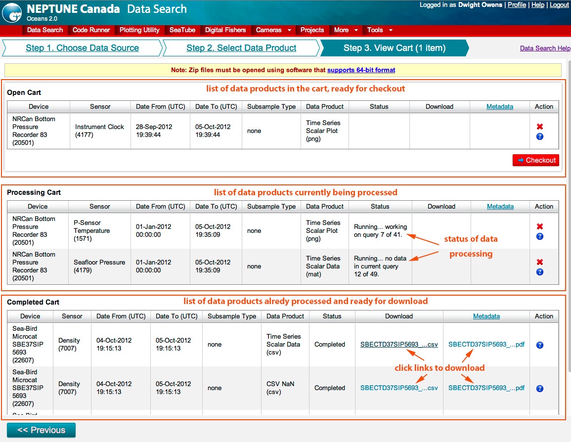
(The subsampling column shown above will be replaced with the data product options in future versions).
...